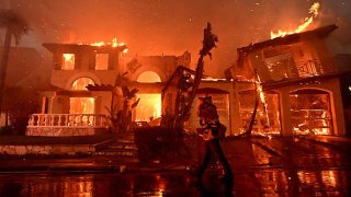
- Wildfire risk is increasing, likely due to global warming, and its destruction is becoming ever more expensive.
- New technology from a Brooklyn-based nonprofit, First Street Foundation, is mapping the threat with house-by-house specificity.
- First Street gives every home a unique score and unique probabilities of risk.
Raging New Mexico and California wildfires may offer an ominous outlook for a growing swath of America, and not just in the West.
Wildfire risk is increasing, likely due to global warming, and its destruction is becoming ever more expensive. Of the wildfires that the National Oceanic and Atmospheric Administration has tracked since 1980, 66% of the damage has occurred in the last five years. Insured damage from wildfires last year totaled $5 billion, according to a Yale University report, marking the seventh consecutive year of insured losses above $2 billion.
Get top local stories in Southern California delivered to you every morning. Sign up for NBC LA's News Headlines newsletter.
Wildfire risk modeling is more crucial than ever to help protect lives and property, and new technology from a Brooklyn-based nonprofit, First Street Foundation, is mapping the threat with house-by-house specificity.
First Street uses everything from property tax data to satellite imagery and assigns a wildfire risk score that factors in construction type, roof type, weather and exposure to natural fuels like trees and grass.
"We calculate every individual property and structure's risk across the country, be it a commercial building, or be it an individual's home," said Matthew Eby, founder and executive director of First Street Foundation. "What you're able to see from that is that one home might have the same probability as another of being in a wildfire, but be much more susceptible to burning down."
Money Report
Certain homes may be more vulnerable because of their building materials, the defensible space around them or the roof type, for example. The company models the immediate risk to Americans' homes and then adjusts for projected climate change.
"We can then use supercomputers to simulate 100 million scenarios of wildfire today, and then another 100 million scenarios 30 years in the future with the forecasted weather conditions," Eby said.
First Street gives every home a unique score and unique probabilities of risk. It did the same for water threats, working with Realtor.com to put a flood score on every property on the home-selling website. That feature is now the second-most clicked map on Realtor.com, behind school district data on K-12 performance.
"The reaction to flood has been overwhelmingly positive. It's really helpful in being able to make informed decisions and to understand what it is to protect your home," said Sara Brinton, lead project manager with Realtor.com.
Potential buyers and homeowners who find their flood and fire scores on Realtor.com can click a link for more information on First Street's site to find out how best to protect their homes.
"On a on a monthly basis, we see tens of millions of impressions against our flood factor data," said Eby.
More than 71% of recent homebuyers took natural disasters into account when considering where to move, according to a recent survey from Realtor.com and analytics company HarrisX. About half of respondents reported being more concerned about natural disasters today than they were five years ago.
The First Street fire model pays particular attention to what it calls the "wildland urban interface," where housing developments butt up against wooded areas.

At least 10 million properties rank somewhere between "major" and "extreme" wildfire risk, according to First Street. While flood risk grows by about 25% over a span of 30 years, wildfire risk overall is doubling and jumping more than 200% in places you might not expect, like New Jersey, Massachusetts, Florida, Louisiana, Alabama and Arkansas.
That change helps explains why big firms, like Nuveen Real Estate, are buying the data to inform their investments.
"The First Street data is helping us get that really close look at how will the building be impacted? And more importantly, how can we reflect this increasing risk in our underwriting?" said Jessica Long, head of sustainability for Nuveen's U.S. real estate portfolio. "We use the data as part of new investment screening as well as part of our annual business-planning process."
For homeowners, the information not only guides them in buying a home, but it can also help in protecting one they already own. The fire score, for example, can help inform minor changes to reduce that risk, like adjusting landscaping or ventilation. Experts say it's much easier to protect a home from wildfire than from major flooding.
When First Street introduced its flood-score feature, the data was met with concern that it would lower the value of homes with higher risk. Realtor.com's Brinton said there have been very few complaints, but added, "In a few places we see homes appreciating somewhat more slowly in areas with high flood-risk scores."


