Around the country, people rely on these piles of snow for their water supply. What is a snowpack, and how else does it impact you?
This year's snowpack in California's Sierra Nevada Mountains, the state's natural water reservoir, is on track to break records, state officials said Monday.
But with drought relief, comes flooding concerns. Just months after the state was dangerously deep in drought, its reservoirs are filling, with the snowpack yet to melt.
The water content of the statewide snowpack as reported by a network of automated sensors on Monday was 237% of average to date, said Sean de Guzman, water supply forecasting unit manager for the California Department of Water Resources.
The storms #California has experienced this year have led to one of the largest #snowpacks on record. While these winter storms have helped the snowpack and reservoirs, we’re preparing with local agencies for the upcoming Spring snowmelt season. pic.twitter.com/RwJ6yTYvuR
That is greater than any previous April reading since the sensor network was deployed in the mid-1980s, de Guzman said. Manual measurements on “snow courses” date back to 1910 and only the years 1952, 1969 and 1983 showed a statewide result greater than 200% of average in April.
The record 1952 measurement was also 237% of average, but there were fewer snow courses measured then and the addition of others over the years makes it difficult to compare across decades results with precision, according to de Guzman.
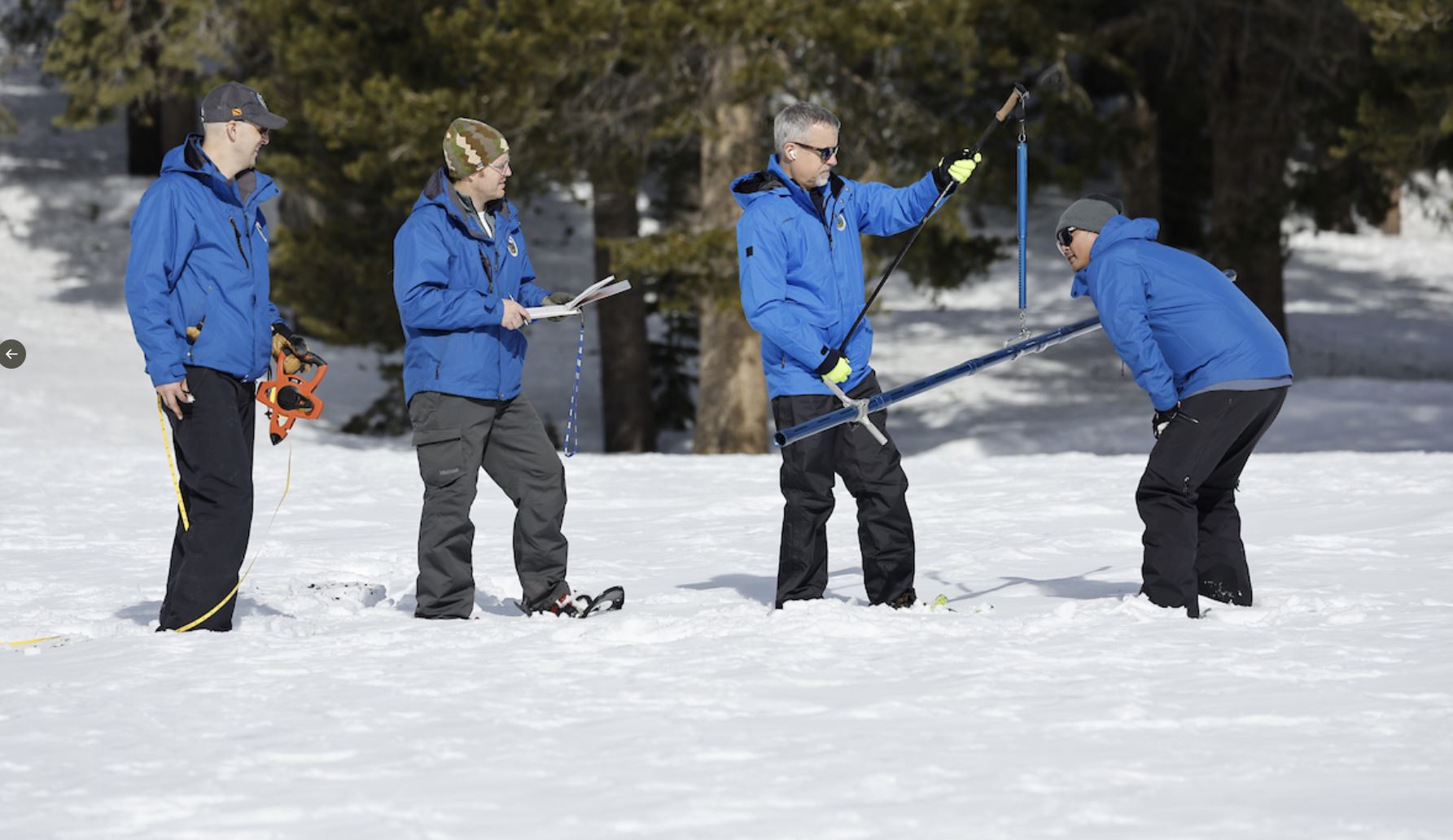
Manual measurements continue to the present day, but weather and other dangers, including the threat of avalanches, have prevented access to some locations.
California’s #snowpack is now one of the largest ever, bringing both drought relief and flooding concerns, however DWR’s State-Federal Flood Operations Center and DWR’s Snow Surveys and Water Supply Forecasting Unit are helping local agencies plan for the Spring snowmelt season. pic.twitter.com/RzSozSDEtM
De Guzman said the state is waiting for more survey results to come in from partners including the National Park Service, the U.S. Forest Service and utility companies.
“But as of right now it’s looking like this year’s statewide snowpack will probably, most likely be, either the first or second biggest snowpack on record,” said de Guzman, who conducted a manual measurement on snow course at Phillips Station near Lake Tahoe.
California was three years into drought, with dwindling reservoirs and parched landscapes, until an unexpected series of powerful storms including more than a dozen atmospheric rivers began in December. The rivers of moisture in the sky fuels storms as they move over the Pacific Ocean, accounting for some of California's wettest winters on record.
While causing widespread damage, the storms also built the extraordinary Sierra snowpack, which supplies about a third of California’s water. Reservoir storage statewide is now 107% of average.
CA DWR
Right, a serpentine stretch of the California Aqueduct in Palmdale, Calif. within Los Angeles County at mile post 327.50. Photo taken February 7, 2014. Left, part of the Sierra Nevada Mountains.
California Department of Water Resources
Before we get to the California Aqueduct, here's where California's water lifeline starts -- a snow-covered Sierra Nevada mountain peak. This view is to the northwest from the Phillips Station meadow where the California Department of Water Resources conducted its third snow survey of the winter 2017 season. Photo taken March 1, 2017.
AP
Here's a look at conditions in the Sierra Nevada, Thursday, March 30, 2017, near Echo Summit, Calif. The location is where the California Department of Water Resources holds its manual snow survey at nearby Phillips Station. In late March 2017, the water content was at 183 percent of normal.
AP
The snowpack is so important, California water resources managers keep a close eye on it. Frank Gehrke, right, chief of the California Cooperative Snow Surveys Program for the Department of Water Resources, lifts the survey tube out of the snowpack depth during the manual snow survey at Phillips Station, Thursday, March 30, 2017.
AP
Water from snowmelt cascades down the South Fork of the American River on May 1, 2017, near Echo Summit. The warming springtime temperatures in California melt the state's snowpack, sending water into rivers and streams from the Sierra Nevada Mountains. (AP Photo/Rich Pedroncelli)
California Department of Water Resources
When the mountain snow melts, it runs downhill in rivers and stream, eventually ending up in the State Water Project. This view is looking north from the California Aqueduct Vista Point, an exit off the southbound 5 Freeway near Exit 423/Stuhr Road in Stanislaus County west of the Sierra Nevada range. Photo taken March 4, 2013.
California Department of Water R
Another view looking north from the California Aqueduct Vista Point in Stanislaus County. This photo was taken July 23, 2015, two years after the previous image during California's recent dry spell.
Paul Hames / California Department of Water Resources
This is an aerial view of the California Aqueduct near Tracy, California. It is the location of a 108-inch diameter interconnect pipeline in the ground between the California Aqueduct, to the left, and the Delta-Mendota Canal, which is part of the Central Valley Project. Photo taken April 20, 2012.
California Department of Water R
Another aerial view of the "intertie" constructed between the Delta-Mendota Canal and the California Aqueduct near Tracy. Photo taken April 20, 2012. Paul Hames / The California Department of Water Resources
John Chacon / California Department of Water Resources
The California Aqueduct is pictured in Alameda County, just north of the Bethany Reservoir.
California Department of Water R
As we head south, the California Aqueduct runs through the brown, dry hills of Newman in July 2015.
California Department of Water Resources
A pastel sky over the California Aqueduct in the San Joaquin Valley. Photo taken April 10, 2014.
AP
This undated file photo released by the California Department of Water Resources shows water making its way south through the Central Valley by way of the California Aqueduct.
Getty Images
Part of the east branch of the California Aqueduct, which imports water from the Sierra Nevada Mountains.
Getty Images
The California Aqueduct passes through the Dos Amigos pumping plant on April 24, 2015 in Los Banos, California.
California Department of Water R
The California Aqueduct near Highway 166 south of Bakersfield. Photo taken December 13, 2012. Florence Low / California Department of Water Resources
California Department of Water Resources
In Kern County, the California Aqueduct is seen at sunset.
John Chacon / California Department of Water Resources
This moonlight view is looking south toward the Tehachapi Mountains in Kern County.
John Chacon / California Department of Water Resources
Twilight falls over Kern County and the California Aqueduct.
California Department of Water R
The California Aqueduct splits into the West Branch and East Branch as it travels into the Southern California region.
California Department of Water Resources
The California Aqueduct bifurcates in the West Branch and East Branch as it travels into the Southern California region at the border of Kern and Los Angeles Counties. Photo taken February 6, 2014.
Florence Low / California Department of Water Resources
Another view of the California Aqueduct as it separates into the East Branch (left) and West Branch (right). Photo taken February 6, 2014.
California Department of Water Resources
The California Aqueduct just north of the A.D. Edmonston Pumping Plant looking west. Photo taken 1992. Dale Kolke / California Department of Water Resources
Florence Low / California Department of Water Resources
Another stretch of the California Aqueduct East Branch in Palmdale. Photo taken on February 7, 2014.
California Department of Water R
Another view of the winding stretch of the California Aqueduct in Palmdale. Photo taken February 7, 2014.
Getty Images
The California Aqueduct carries water from the Sierra Nevada Mountains through the high desert communities north of Los Angeles.
Getty Images
The California Aqueduct carries water from the Sierra Nevada Mountains to southern California. A segment the aqueduct is pictured in May 2008 near Palmdale.
Getty Images
The California Aqueduct carries water from the Sierra Nevada Mountains to Southern California. This picture is near Palmdale in May 2008.
Getty Images
The California Aqueduct carries water from the Sierra Nevada Mountains in May 2008 through Palmdale to other parts of Southern California.
California Department of Water R
This stunning aerial image shows a serpentine stretch of the California Aqueduct in Palmdale. Photos taken on February 7, 2014. Florence Low / California Department of Water Resources, FOR EDITORIAL USE ONLY
CA Department of Water Resources
This aerial view looks north toward Pyramid Dam and Pyramid Lake located on Piru Creek in Los Angeles County. The reservoir provides emergency storage for deliveries from the West Branch Aqueduct. It's also a popular recreational site for Southern Californians. Photo taken May 9, 2014.
John Chacon / California Department of Water Resources
A warning sign along the California Aqueduct East Branch. This location is where Highway 138 crosses the Aqueduct near the community of Neenach in Los Angeles County. Photo taken April 25, 2013.
Getty Images
Another view of the Los Angeles Aqueduct, which carries water from the snowcapped Sierra Nevada Mountains to the Los Angeles area.
Getty Images
Separate from the California Aqueduct network is the the Los Angeles Aqueduct, built and maintained by the the LADWP. Unlike most of the water collected from the Sierras, the LA Aqueduct receives its water from runoff on the eastern side of the mountains. Here, it is seen with snowcapped Sierra Nevada Mountains in the background, carrying watter to major urban areas of southern California on May 9, 2008 near Lone Pine.
“The real challenge as we move into spring and summer though is flooding — significant flooding — particularly in the Tulare Lake Basin,” said Karla Nemeth, director of the Department of Water Resources.
The basin once held Tulare Lake, a vast body of water in the Central Valley below the western slope of the Sierra. Settlers began draining it or diverting its water sources in the 19th century, converting it to farmland. The lake has already begun to reemerge due to this year's runoff.
Snowmelt runoff projections will be released next week, but de Guzman predicts records will be broken. That will include “an absurdly high 422% of average” for the Kern River watershed, which drains into the southern end of the Central Valley, he said.
NBCLA's Jonathan Lloyd contributed to this report.