Winds will gain strength Monday when a red flag warning goes into effect for parts of Southern California. Shanna Mendiola has the forecast for the next round of strong winds.
What to Know
- Evacuation orders remain in effect for the Eaton Fire and Palisades Fire in Los Angeles County nearly a week after they started in a Santa Ana windstorm.
- Strong winds return Monday night and continue through Wednesday for parts of Southern California.
- A red flag warning will be in effect, indicating dangerous wildfire conditions.
- Some areas will be under a Particularly Dangerous Situation (PDS) red flag warning, indicating elevated fire conditions beyond a typical red flag warning.
- The Palisades Fire, Eaton Fire and Hurst Fire have burned a combined 38,600 acres in Los Angeles County.
Winds will gain strength Monday when a red flag warning goes into effect for parts of Southern California ahead of an more severe fire weather warning as two large wildfires burn in Los Angeles County.
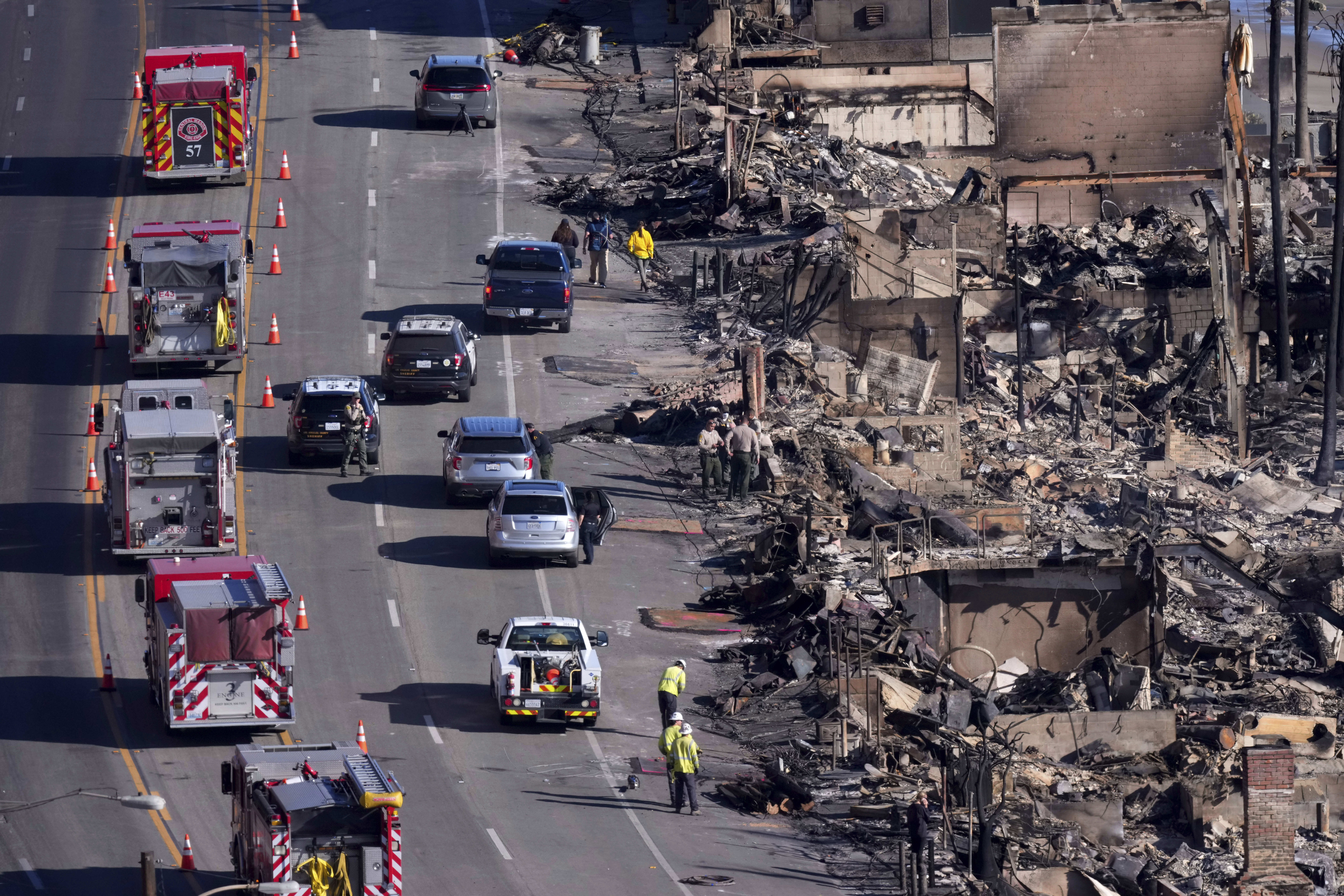
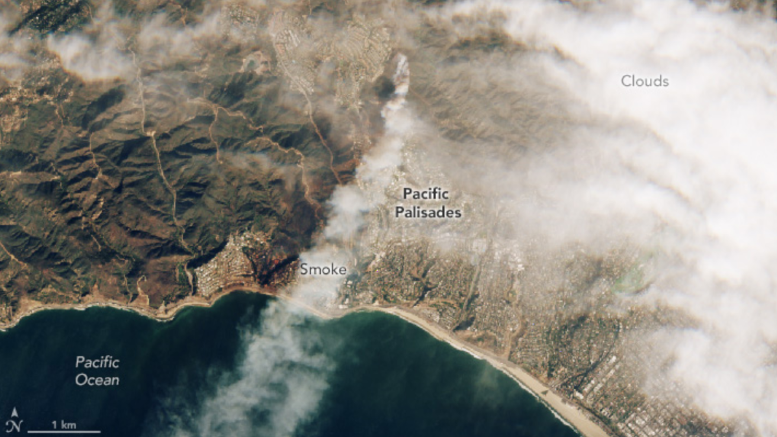
The red flag conditions return after a weekend when winds diminished, allowing firefighters to increase containment of the Palisades Fire and Eaton Fire, two of the most destructive wildfires on record in California. The fires started Jan. 7 during a powerful Santa Ana windstorm.
Get top local stories in Southern California delivered to you every morning. Sign up for NBC LA's News Headlines newsletter.
This week's strong winds arrive Monday night and continue into mid-week.
"We'll see some of the strongest winds begin (Monday night) and last all the way through Wednesday morning," said NBC4 meteorologist Shanna Mendiola. "So, that's when we're going to see those red flag warnings pop up, and within those red flag warnings, a Particularly Dangerous Situation (PDS) red flag warning embedded in this one."
A red flag warning indicates dry and windy conditions that could lead to the rapid spread of a wildfire. Areas under a PDS red flag warning will see elevated fire weather conditions beyond the typical red flag warning.
"The National Weather Service issues this when it's a really critical situation," Mendiola said.
■ Evacuation Warning ■ Evacuation Order
Updated Jan. 24, 2025 at 2 p.m. PT
This will be the fourth time in three months that the NWS has issued the elevated warning.
A widespread part of Southern California was under a PDS red flag warning when the Palisades Fire and Eaton Fire broke out a week ago. Fanned by powerful wind gusts reaching 90 mph, flames destroyed entire neighborhoods in what firefighters described as some of the worst conditions they have seen.
"(The winds) are not going to be as strong as the last round, but notice how they continue. They stay consistent," Mendiola said. "We have those rounds of gusts that come through, those occasional bursts of wind that could cause issues."
Winds gusting from 20 mph to 50 mph are in this week's forecast with isolated mountain gusts reaching 70 mph.
"There will be a fire threat in all of Los Angeles County," said LA County Fire Chief Anthony Marrone.
Another problem for firefighters is that high winds can ground water-dropping aircraft, which can be critical to prevent a small fire from spreading in steep and rugged terrain that is difficult to access. Gerry Magaña, of Cal Fire, said sustained winds over 40 mph pose a risk for most aircraft, but peak gusts limit aircraft capabilities, affecting approach, departure and drop accuracy.
"Each aircraft has limits based on manufacturer recommendation," Magaña said at a Monday news conference. "Anything over 40 mph sustained is pretty much going to ground most aircraft."
What parts of LA will be under a red flag warning?
The red flag warning will be in effect from 10 p.m. Tuesday to noon Wednesday, but could be extended. Areas under the warning will see moderate Santa Ana winds and low humidity, creating extreme fire danger.
Those areas include the Ventura County mountains and coast, Malibu, the Santa Clarita Valley north of Los Angeles, parts of the San Fernando Valley, the San Gabriel Mountains, much of inland Orange County and parts of the Inland Empire.
Here's what to know about LA's wind forecast.
Heads up! Strong, locally damaging, NE/E winds will affect West LA Co. & much of Ventura Co thru Wednesday. Critical fire weather is expected, so PLEASE have multiple ways of getting notifications in case of new fires & prepare ahead of time. #venturacounty #LA #Cawx #Socal pic.twitter.com/BuvqcwnktS
— NWS Los Angeles (@NWSLosAngeles) January 12, 2025
What areas will be under a PDS red flag warning?
The elevated PDS red flag warning goes into effect Tuesday at 4 a.m. It will cover three parts of Los Angeles and Ventura counties.
- The 5 Freeway corridor in northern Los Angeles County known as the Grapevine.
- A large swath of the region from the San Fernando Valley into Ventura County, including Ventura, Fillmore, Simi Valley, Porter Ranch and other locations.
- Western Santa Monica Mountains above the Los Angeles County coast.
The Los Angeles basin and the Eaton Fire area northeast of LA will be sheltered from the strongest winds. During last week's windstorm, strong gusts were reported in areas that do not usually see the most powerful winds.
Strong winds aren't the only threat. On Sunday during a lull in the winds, the Palisades Fire flared up in the Mandeville Canyon area west of the 405 Freeway as it burned dry brush that provided ample fuel for flames. Many of Southern California's hillsides are covered in dry brush after a dry start to the region's wet season.
The elevated fire threat continues through Wednesday.
About 92,000 people in Los Angeles County were under wildfire evacuation orders early Monday. Some areas were re-populated and downgraded Sunday to evacuation warnings, meaning residents should be prepared to evacuate.
What are Santa Ana winds?
Wind moves from high pressure to low pressure. When you add Southern California's rugged topography of mountains, canyons and passes, that wind can now pick up speed as it's channeled through those areas.
"They're specific to our area because of the topography," said Mendiola. "High pressure and low pressure play a big part in this. Our winds flow from high to low, and they come through the passes and canyons. We call these the offshore winds. They come from the deserts through the passes over the mountains and compress downhill."
As the air gets to the top of the mountain it races down, it acts like a bike with no brakes and gaining speed. The canyons and passes act as a toll road. The wind piles up and once it squeezes through the canyon it races out in a powerful blast of wind.
And wind that is moving down a mountain dries as it sinks. It’s more physics than meteorology, but this drying lowers the humidity into the single digits. The combination of dry fuels, low humidity, and strong gusty winds create a critical fire weather threat. If a fire starts it can spread rapidly and behave erratically due to wind gusts.
Santa Ana winds occur in the fall lasting through the winter.


