What to Know
- The fire is at more than 20,000 acres with 36% containment as of Monday morning.
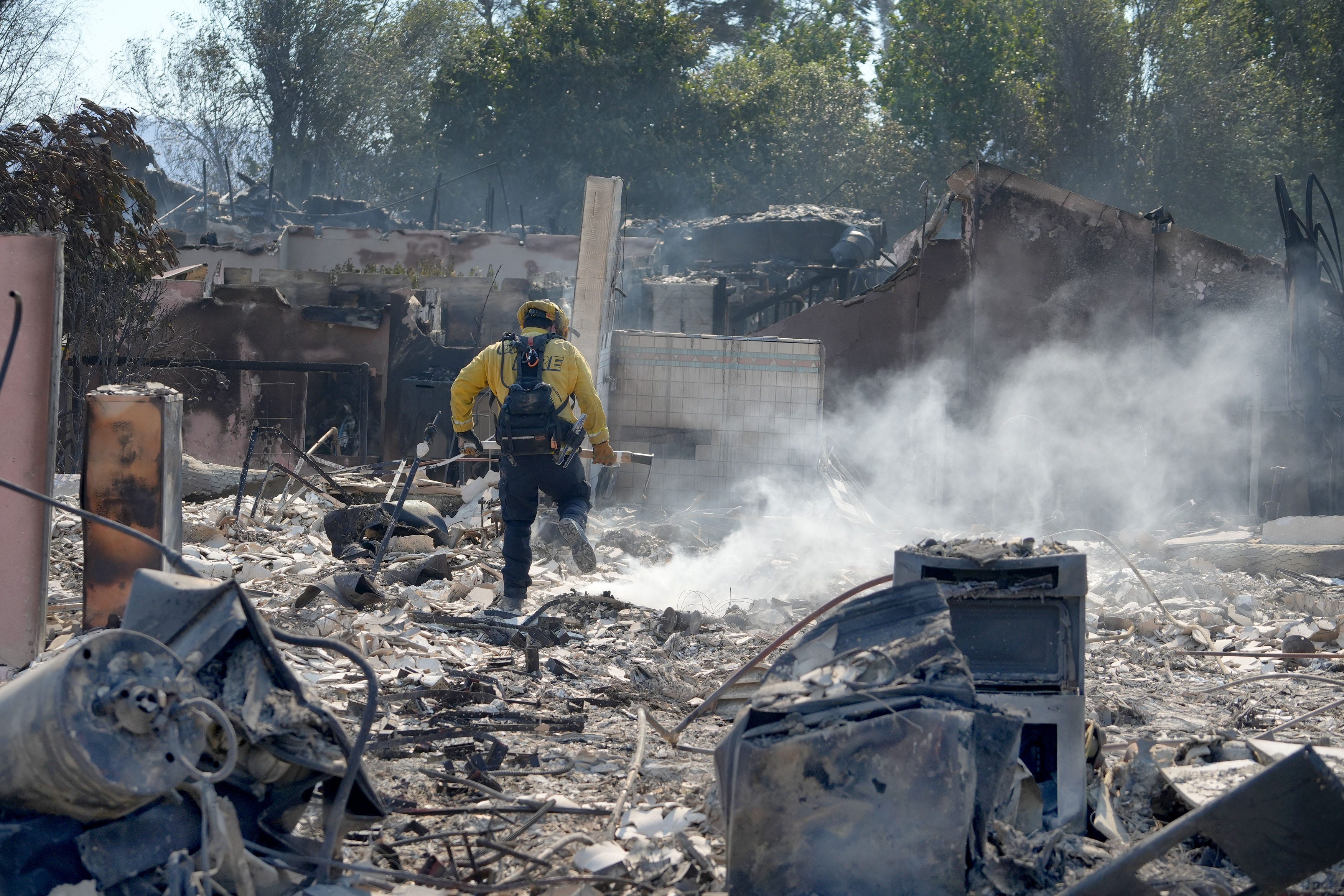
- As of Sunday morning, the blaze has destroyed 134 structures and damaged 46 others, according to Cal Fire
- Six people were injured in connection with the blaze.
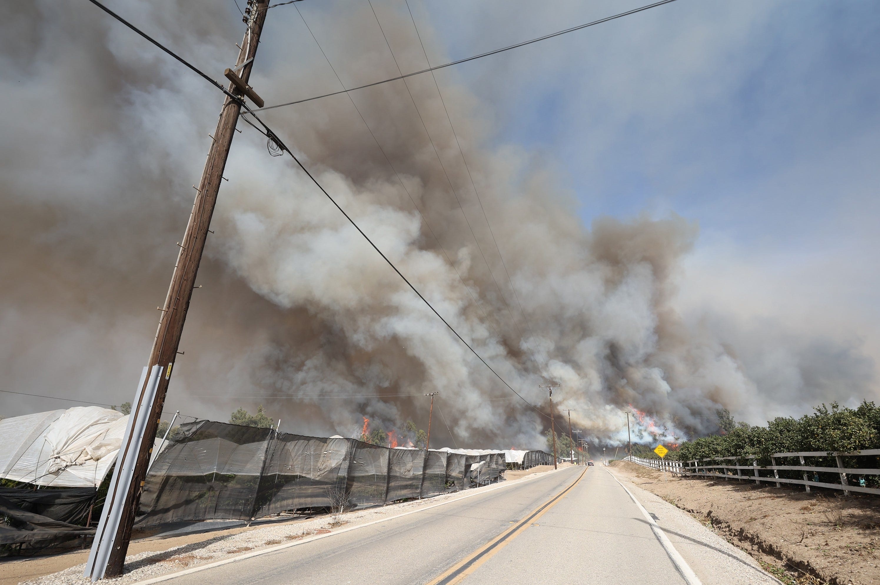
The fire that’s consumed several homes in Ventura County and forced residents to vacate their properties has been contained by 36%, firefighters announced Monday morning.
The Mountain Fire, which swelled to 20,630 acres as of Monday, has burned through neighborhoods in Camarillo and Moorpark since Wednesday morning. With the help of unseasonably warm temperatures and Santa Ana winds, the fire quickly spread to about 15,000 acres in just 24 hours, devastating communities in its path.
According to Cal Fire, 134 structures have been destroyed and at least 46 others were damaged. Aerial footage from NewsChopper 4 showed several homes set ablaze by the fire. Others were seen reduced to rubble.
Get top local stories in Southern California delivered to you every morning. >Sign up for NBC LA's News Headlines newsletter.
Evacuation orders
- Zone 1 – Area east and south of Bradley Road, north of CA-118, west of Balcom Canyon Road
- Zone 2 – Area east of CA-118, south of Southern Pacific Milling Road, north of West Mountain Road
- Zone 3 – Area south of Hwy 118, west of Aggen Road, north of San Miguel Drive and east of and including Garrido Drive and Piropo Court
- Zone 4E – Areas south of and including east section of Valley Vista Drive, areas west of and including Esteban Drive and Corriente Court, select residences on Calle Converse and Calle Alberca
- Zone 4F – Avocado Place north of Crestview and south of Ramona Place
- Zone 6 – Area extending south of Santa Clara River, east of Los Angeles Avenue, north of Saticoy County Club, and west of Briggs Road
- Zone 8 – Area west of Santa Paula Community Golf Course, north to the Santa Clara River, South to Somis
- Zone 9 - Area east of Santa Paula Community Golf Course, north along Santa Clara River, west of San Cayetano Street
- Zone 11 – Area south of the Santa Clara River, north of the ridge bottom of South Mountain at the rock quarry, west of Grimes Canyon Road, east of San Cayetano Street
- Zone 12 – Area north of Los Angeles Avenue, west of Grimes Canyon Road, east of San Caytano Street, south of the ridge bottom of South Mountain at the rock quarry
Evacuation warnings
- Zone 1A – Area east of La Vista Avenue, south of West and East La Loma Avenue, west of Bradley Road, north of CA-118
- Zone 2A – Area south of Lloyd Butler Ranch Road and West Mountain Road, west of La Vista Avenue, east of CA-118, north of Beardsley Avenue
- Zone 3A (Partial) – Area east of and including Ocean View Drive to Somis Road
- Zone 4A (Partial reopening of Zone 4) – Area north of Las Posas Road, west of Anacapa Drive, east of Crestview, south of and including Calle Higuera, Calle Converse, Sierra Mesa Drive, Alta Seguna Court, Alborada Drive and San Miguel Drive.
- Zone 4B (Partial reopening of Zone 4) – Area southeast and southwest of Beardsley Road, east of Central Avenue, north of and including Avenida de Autlan, all of Via Aracena to Crestview, west of Las Posas Road, north of West Ponderosa and south of Crestview Avenue
- Zone 4C – Las Posas Country Club, including and areas south of Fairway Drive, east of Beardsley Road, northeast of and including Ramona Drive, north and northwest of Calle Aurora, northwest of Deseo Avenue, west of Center School Road
- Zone 4D – Areas north and east of and including Ramona Place, southwest of Las Posas Equestrian Trail above Alviso Drive, north of Crestview Avenue, west of Valley View Drive, Encino Drive, east of but not including Avocado Place below Ramona Place
- Zone 10 – The area that extends east of 12th Street to Willard Road, south to Hwy 126 along the Santa Clara River
Evacuation shelters
- Residents -- Padre Serra Parish. 5205 Upland Rd., Camarillo, CA 93012
- Large animals -- Ventura County Fairgrounds. 10 E. Harbor Blvd., Ventura, CA 93001
- Small animals -- Ventura County Animal Services (Camarillo Airport). 600 Aviation Dr. Camarillo, 93010
It’s unclear how many of the structures that were destroyed were homes, but those who’ve lost their properties tell NBC4 that all they can do now is start over.
“You know, you see this stuff on TV, you feel for them,” said Rebecca Vallejo, a Camarillo Heights resident whose home was destroyed. “You go, ‘Oh, I’m so sorry.’ And then, when we walked up, it’s just … I was like, ‘Oh, my gosh. It’s gone.’”
Vallejo became emotional when telling NBC4 how the flames consumed her late husband’s artwork. Her relative, Sideney Bozung, said the loss of their home has been difficult to process since her father and grandfather, who lived in the home, passed away prior to the blaze.
“We kind of have nothing left but our family, so it really just makes you think -- is it all worth it,” Bozung said. “Keeping a bunch of things or staying contact with family and being there for each other?”
The California Fire Foundation is providing crews with $250 gift cards to hand out to those who were impacted by the blaze.
Gov. Gavin Newsom declared a state of emergency in Ventura County due to the blaze. Additionally, he issued an executive order to support firefighter and recovery efforts.


