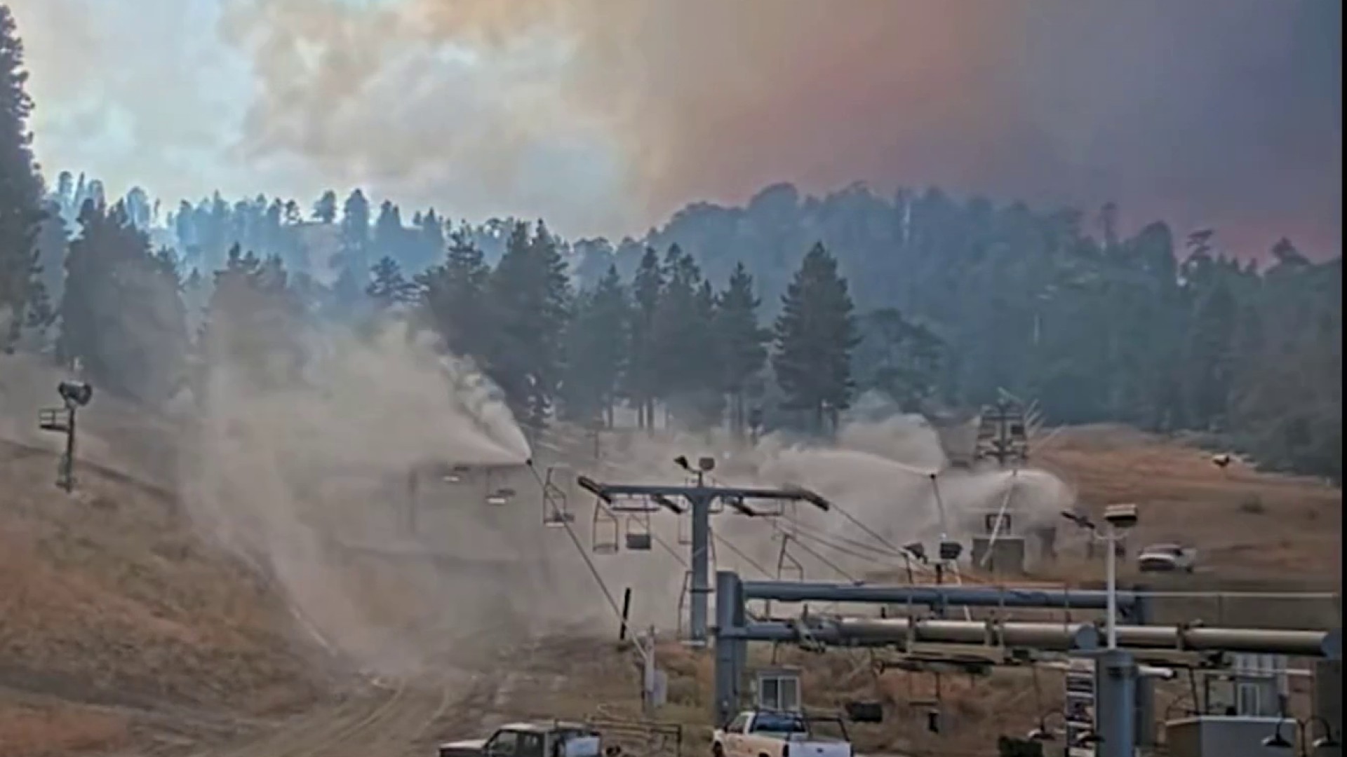
In a community meeting in Phelan, fire officials shared with neighbors the progress being made on the Bridge Fire that has burned over 53,000 acres. Lauren Coronado reports for the NBC4 News at 11 p.m. on Sept. 14, 2024.
This story will no longer be updated, for the latest information on the Bridge Fire, click here.
Firefighters on Saturday continued to battle the Bridge Fire that spread from San Gabriel Canyon above Glendora into San Bernardino County and burned 53,738 acres. It raged as the largest active fire in Southern California.
As of Saturday evening, the fire was 5% contained, primarily on the southwestern flank, according to CalFire.
"Today, the Bridge Fire had minimal movement," Cal Fire said in the latest update Saturday. "Firefighters continued to mop-up hot spots, establish or strengthen containment lines along the entire perimeter of the fire where accessible to do so. Resources were focused on the northern area of the fire where air operations dropped water as needed along the fire line near the communities of Big Pines and Wrightwood.
Get top local stories in Southern California delivered to you every morning. >Sign up for NBC LA's News Headlines newsletter.
Bridge Fire
"Although the fire is slowly backing downhill on the east side, firefighters are not letting their guard down in Icehouse Canyon where the rugged terrain still presents some challenges. Heat and active flames are also still present in the Mt.Baldy Village area, and crews continue to prioritize structure protection.
"A marine weather inversion aided crews along the southern boundary in establishing direct line, extending from the southwest toward the east with mop-up. Favorable winds are also keeping the west side of the fire within its current footprint where the steepest and most rugged terrain lies within the wilderness."
Fire officials said humidity is still low in higher elevations, but in lower elevations, the marine layer and higher humidity were helping crews make "great progress in strengthening both primary and secondary containment lines in the southeast, south and southwest flanks of the fire, while also gaining depth in their mop-up operations."
The Incident Management Team scheduled a public meeting at 6 p.m. Saturday at Serrano High School Performing Arts Center, 9292 Sheep Creek Road in Phelan that will be live streamed on the Angeles National Forest Facebook page.
The blaze began at 3 p.m. last Sunday near East Fork and Glendora Mountain roads, according to forest officials. The fire initially remained relatively small, but it exploded in size at the tail end of an extended heat wave on Tuesday, destroying dozens of structures as it marched into San Bernardino County.
It is the largest active fire in the state.
Evacuation orders
- the entire community of Wrightwood
- Highway 138 south to Lone Pine Canyon and Highway 2 east to Lone Pine Canyon Road;
- Lone Pine Canyon from the community of Wrightwood to Highway 138/Lone Pine Canyon Road south to the forest;
- East Fork communities of Camp Williams Resort (cafe, mobile home park, campground) and River Community (near the resort); and
- Mt. Baldy Road, North Mountain Avenue and Shinn Roads from San Antonio Heights to Wrightwood and east to Cucamonga Peak.
A mandatory evacuation order that had been in place in the area of Highway 18 south to Highway 138 and Beekley Road west to the Los Angeles County line was downgraded to a warning.
Evacuation warnings
- Phelan from Highway 138 east to Baldy Mesa Road and Phelan Road south to Sayle Road;
- San Antonio Heights and Upland from the foothills south to 23rd Street;
- Pinon Hills from Wrightwood north to Highway 138 and Lebec Road west to Los Angeles County.
Evacuation warnings were lifted Friday in the communities of Baldwin Lake and Lake Williams from Highway 38 north to Highway 18 and Baldwin Lake East, and in the area of Phelan Road south to Forest Route 3N24 and Baldy Mesa Road west to Tumbleweed Road.
Evacuation centers
- Pomona Fairplex: 601 W McKinley Ave., Pomona (Enter Gate 3, corner of McKinley and White);
- Hacienda Heights Community Center, 1234 Valencia Ave.;
- Jessie Turner Center, 15556 Summit Ave., in Fontana.
Animal evacuation centers
- Palmdale Animal Care Center (small animals): 38550 Sierra Highway, Palmdale;
- Lancaster Animal Care Center (small animals): 5210 W. Ave. I, Lancaster;
- Antelope Valley Fairgrounds (large animals): 2551 W. Ave. H, Lancaster (call 562-706-8581 prior to arrival);
- Devore Animal Shelter (pets/livestock): 19777 Shelter Way, San Bernardino (call 909-386-9820, or after hours 800-472-5609).
Road closures
- SR-138 from Lone Pine Canyon Road to Beekley Road;
- SR-2 closed from Big Pines to SR-138;
- Big Pines Highway;
- Big Rock Creek Road;
- San Gabriel Canyon and East Fork of the San Gabriel River;
- Highway 39;
- East Fork Road;
- Glendora Ridge Road;
- Glendora Mountain Road; and
- Mount Baldy Road at Shinn Road intersection
Cal Fire officials estimated that the fire had destroyed 19 residential, commercial and other structures and damaged another six. However, more than 11,000 structures were still being threatened as of Saturday.
No significant injuries were reported.


