This story will no longer be updated, for the latest information on the Line Fire, click here.
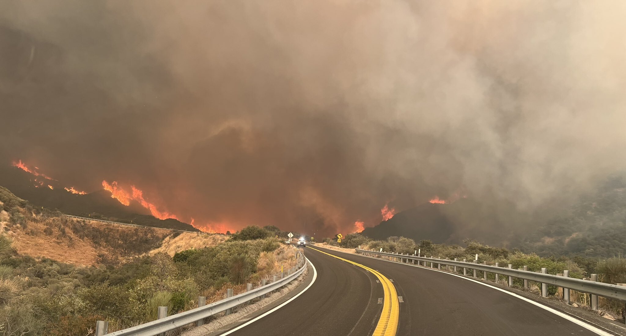
A state of emergency has been declared in San Bernardino County as firefighters continue battling a more than 20,000-acre blaze amid a sweltering heat wave that’s been scorching Southern California.
The quick-moving Line Fire began burning in Highland on Thursday and has since grown to 20,552 acres and only 3% contained as of Monday morning, according to Cal Fire. Thousands of people have been ordered to evacuate their homes as crews not only battle the blaze, but the elements that are contributing to the fire’s growth.
Get top local stories in Southern California delivered to you every morning. >Sign up for NBC LA's News Headlines newsletter.
Spreading rapidly through the San Bernardino National Forest, the Line Fire has posed a challenge to firefighters since steep terrain, triple-digit temperatures and thunderstorms have contributed to the erratic fire behavior.
About 600 firefighters are working to contain the fire, which is threatening roughly 8,000 structures near its path.
“First thing I grabbed was my mother’s ashes,” said Blaine Bacher, an Arrowbear Lake resident who vacated his home. “Second thing I grabbed was my dog’s things and next thing I did was make sure that my stepdad got his butt out of there and then everything else was an afterthought.”
The following evacuations have been issued:
Evacuation orders
- CA-38 and Middle Control Rd, Angelus Oaks
- Garnett Street east to the 138 and Mill Creek north to the foothills
- The area from Calle Del Rio to Hwy 38, including Greenspot Road North
- All underdeveloped land east of Highway 330 to Summertrail Place and north of Highland Avenue
- The areas of Running Spring east of Highway 330 and south of Highway 18
- The communities of Running Springs and Arrow Bear Lake
- The area east of Orchard Road to Cloverhill from Highland Avenue north to the foothills
- North of Highland Avenue and East of Palm Avenue to Highway 330
Evacuation warnings
- Neighborhoods east of Church Street, north of Highland Avenue
- Neighborhoods east of Weaver, north of Greenspot to the Iron Bridge
- Green Valley Lake
- Cedar Glen, Lake Arrowhead, Crestline, and Valley of Enchantment
Road closures
- Highway 18 is closed going northbound (inbound) from Kuffle Canyon to Running Springs. Only southbound (outbound) traffic is allowed.
- Highway 18 is closed from Running Springs to Highway 38 (Big Bear Dam).
- Highway 330 is closed from Highland Ave to Highway 18 in Running Springs.
Evacuation shelters
- San Bernardino County Fairgrounds, Building 6 -- 14800 7th St., Victorville, CA 92395
- Jesse Turner Community Center -- 15556 Summit Ave., Fontana, CA 92336
- Devore Animal Shelter (Large and Small Animals) -- 19777 Shelter Way, San Bernardino, CA 92407
Air quality
Due to the fire, the South Coast Air Quality Management District (AQMD) issued a wildfire smoke advisory for a large part of the Southland that ranges from Menifee to just above Santa Clarita.
The AQMD said that satellite imagery showed smoke passing overheard across the South Coast Air Basin. Monitors and sensors detected that areas near the Line Fire measured at AQI levels that ranged from moderate to hazardous, with the highest levels recorded in Highland, Running Springs and Lake Arrowhead.
As a result, the advisory will be in effect through 5 p.m. Sunday.
State of emergency
Gov. Gavin Newsom’s state of emergency proclamation allows for state aid in the firefight and support for residents who may be impacted.
As part of the response, the state has secured a Fire Management Assistance Grant (FMAG) from the Federal Emergency Management Agency (FEMA). The declaration also allows residents who may be displaced by the blaze to have easier access to unemployment benefits and fees waived for legal documents such as marriage and birth certificates, and replacement for driver’s licenses.


