Tropical Storm Hilary arrived in Southern California Sunday, bringing rain and the threat of catastrophic flooding.
A State of Emergency was declared for Southern California Saturday as the region prepared for the storm's arrival.
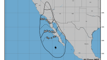
Use the map below to track Hilary's progress.
Get top local stories in Southern California delivered to you every morning. >Sign up for NBC LA's News Headlines newsletter.
How strong is Hilary right now?
Once a Category 4 hurricane, Hilary weakened to a tropical storm Sunday morning. Although winds speeds will decrease, the storm will bring hours of rain to the region.
How is Hurricane Hilary affecting Los Angeles?
Local
Get Los Angeles's latest local news on crime, entertainment, weather, schools, COVID, cost of living and more. Here's your go-to source for today's LA news.
Several events in the LA area have been canceled and postponed. As of Saturday morning, the LA Parks system announced it will close its buildings and facilities.
The LAFC and LA Galaxy events scheduled for Sunday Aug. 20 have been postponed. Sunday's event at Grand Park has moved to a virtual event out of precaution.
LA Mayor Karen Bass advised residents to take the storm seriously, stay informed and stay safe.
Take a look at the map below for the expected wind times.

What warnings have been issued?
For the first time ever, Southern California is under a tropical storm warning.
On Saturday at around 11:46 a.m., the San Bernardino County Sheriff issued an evacuation warning for the communities of Oak Glen, Forest Falls, Mountain Home Village, Angelus Oaks, and northeast Yucaipa due to the tropical storm system.


