What to Know
- California's first significant storm of the season brought rain and snow to Northern California.
- Flooding, rockslides and debris flows are possible as the storm moves slowly through Northern California, Oregon and Washington.
- In Southern California, the storm brings a chance of rain this weekend and into next week, but impacts will be minimal.
- Weekend temperatures will dip to well below normal in Los Angeles with cloudy skies
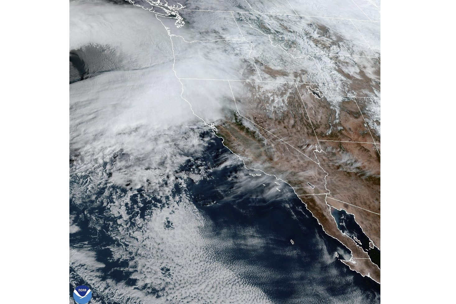
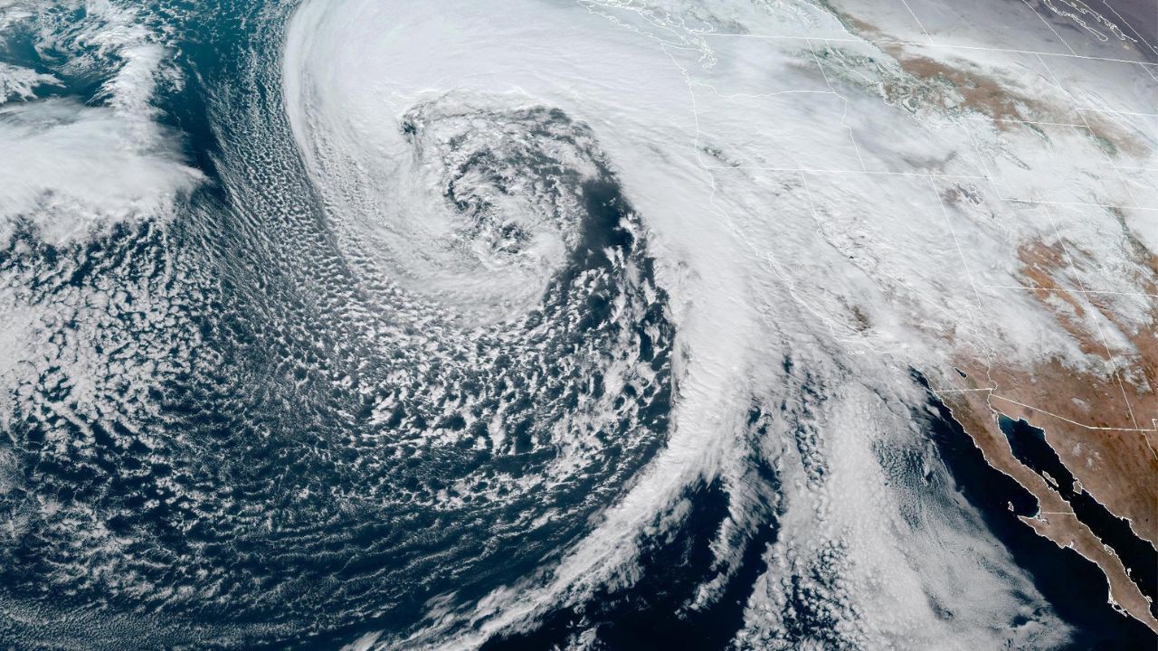
- The storm is tapping into an atmospheric river over the Pacific as it moves toward the West Coast.
- The U.S. Drought Monitor report issued Thursday showed only 16 percent of California in moderate drought.
A powerful fall storm that delivered rain and snow to Northern California this week will continue to pummel the region and impact weather conditions this weekend as it slides toward Southern California.
A flood watch remained in effect through Saturday for communities north of the Bay Area due to the storm fueled by an atmospheric river. The long band of moisture over the Pacific is associated with some of California's most destructive storms.
Get top local stories in Southern California delivered to you every morning. Sign up for NBC LA's News Headlines newsletter.
Flash flooding, rockslides and debris flows were possible in Northern California as the storm moves slowly through California, Oregon and Washington.
The high pressure system keeping most of the rain to the north will begin to slide east, opening the door for wet weather to the south this weekend and into next week.
"The impacts that we're going to see here in Southern California are not going to be as extreme as what's happening in Northern California," said NBCLA meteorologist Belen De Leon. "The reason why we're seeing all these concerns is because you have this really strong storm that's tapped into an atmospheric river. The storm is stationary, so it continues to dump rain and snow over Northern California."
Here's what to know about California's first significant storm of the season.
When to expect rain in Los Angeles
The most significant rain and snow will stay to the north, but Southern California can expect to see cooler and cloudy conditions this weekend and possibly rain.
"The weather is really changing on us this weekend," said De Leon. "It's going to be cooler, and we'll see that chance of rain."
The first chance arrives Saturday. Rain will be light with minimal impacts. The chance of rain increases Saturday morning through the evening.
"If you're doing any traveling, we could have slick roads," said De Leon.
A second storm arrives Sunday, bringing a chance of rain through Tuesday. Temperatures will dip to well below normal Sunday with cloudy skies. The chance of rain increases Sunday into Monday.
"There's still some uncertainty with that storm system, but it does look like it could have a heavier amount of rain," said De Leon. "That could bring minor flooding."
Northern California storm forecast
Up to 16 inches of rain was forecast in Northern California and southwestern Oregon through Friday. By Wednesday evening, some areas in Northern California had seen heavy rain, including Santa Rosa, which had seen about 5 inches within 24 hours.
Dangerous flash flooding, rockslides and debris flows were possible. About a dozen small landslides were reported in northern California in the last 24 hours, including one on Highway 281 on Wednesday morning.
A winter storm watch was in place for the northern Sierra Nevada above 3,500 feet, where 15 inches of snow was possible over two days. Wind gusts could top 75 mph in mountain areas. Only 50 vehicles per hour were allowed through part of northbound Interstate 5 from 10 miles north of Redding to 21 miles south of Yreka due to snow, according to the state’s Department of Transportation.
There were reports of about 9,000 power outages Thursday morning in California, down from more than 20,000 on Wednesday night.
About 150 flights were delayed and another two dozen were canceled early Thursday at San Francisco International Airport, after hundreds were delayed and dozens were canceled on Wednesday, according to tracking service FlightAware.
In Washington, there were more than 320,000 power outage reports Thursday morning from strong winds and rain on Tuesday night, according to poweroutage.us.
“We haven’t had a storm like this since January of 2012,” said Mary Kipp, president of Puget Sound Energy, which serves over 1.2 million electric customers in the state. She estimated Thursday that it would be at least a few days for full restoration.
Falling trees struck homes and littered roads across western Washington, killing at least two people. One woman in Lynnwood was killed when a large tree fell on a homeless encampment, while another woman in Bellevue was killed when a tree fell on a home.
More than a dozen schools were closed in the Seattle area Wednesday and some opted to extend those closures through Thursday.
The U.S. Drought Monitor report issued Thursday showed only 16 percent of California in moderate drought. Seventy-one percent of the state is considered abnormally dry.


