
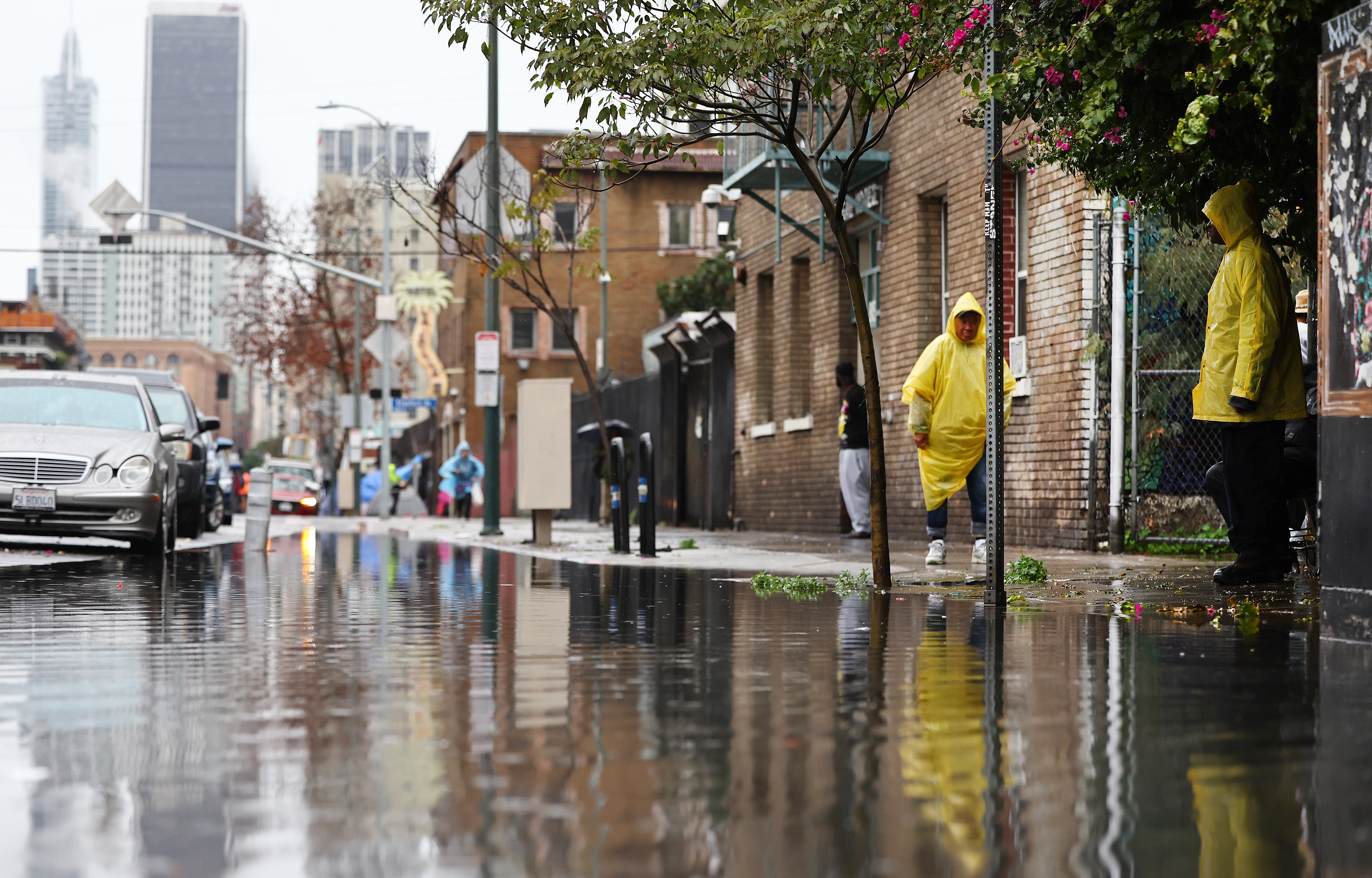
Flood watches remain in effect Wednesday for parts of Southern California after days of rain that shattered long-standing records and led to hundreds of slides in Los Angeles.
Rain began to diminish late Tuesday after the storm that arrived Sunday afternoon delivered 7.03 inches of rain Sunday and Monday for downtown LA's highest two-day rainfall total in the month of February, typically the region's wettest month of the year. It was the third-wettest two-day total on record for downtown Los Angeles.

Flood watches are in effect Wednesday for parts of Orange, San Bernardino and Riverside counties, where scattered showers with brief heavy rainfall are in the forecast. More widespread moderate to heavy showers are possible Wednesday night.
Get top local stories in Southern California delivered to you every morning. Sign up for NBC LA's News Headlines newsletter.
The rain chance continues through the rest of the week.
"We're going to continue to see that chance of rain through Friday every single day," said NBCLA forecaster Belen De Leon. "Don't worry, it's not going to be as much as we had at the start of the week, but because the ground is so very saturated, we could still see the risk of flooding."
A voluntary evacuation warning remains in effect for Silverado, Williams, Modjeska and Trabuco canyons in Orange County due to the possibility of heavy rain. Canyon residents were encouraged to prepare and voluntarily evacuate, especially anyone who might need extra time to leave.
In the mountains, lingering snow and light rain are possible throughout the day due to a weaker system sliding in from Northern California.
More widespread light showers are possible Wednesday evening before a brief burst of rain.
Los Angeles County is expected to receive about another half-inch to 1.5 inches of rain by Friday across most of the area with more in mountain communities. The additional rain raises the slide threat on already soaked hillsides. Between Sunday and Tuesday, the LAFD said it received more than 300 reports of slides, some leaving buildings red-tagged and uninhabitable.
Conditions dry out over the weekend with a slight warming trend through next week.
A winter storm warning will remain in effect until 8 a.m. Thursday in the eastern San Gabriel Mountains, where 20 inches of additional snow could fall above 7,000 feet. As much as 3 inches are possible as low as 3,000 feet.
A winter weather advisory will remain in effect until 8 a.m. Thursday in the western San Gabriel Mountains and the Antelope Valley (14) and northern Golden State (5) freeway corridors.