What to Know
- A storm brings light to moderate rain to Los Angeles through most of Friday with the steadiest rain tapering off around 5 p.m.
- Snow will fall at higher elevations without the blizzard conditions that plagued mountain communities in late February.
- Expect rain in all mountain communities and resorts, which could combine with several feet of snow from the last storm to cause problems.
A storm fueled by an atmospheric river over the Pacific Ocean will bring rain and high-elevation snow Friday and possibly into the weekend in Southern California.
No watches or warnings were issued ahead of the storm, a warmer system that will not bring nearly as much precipitation as the late February cold storm that triggered a rare blizzard warning, landslides, flooding and other weather-related problems. Flooding due to more significant rainfall is expected in Northern California, where residents are still dealing with the aftermath of earlier storms.
The system will draw moisture from an atmospheric river over the ocean. The long plumes of moisture contributed to some of California's most powerful storms on record, including the system that brought historic snowfall to Southern California's mountains and days of rain elsewhere.
Get top local stories in Southern California delivered to you every morning. >Sign up for NBC LA's News Headlines newsletter.
Here's what to expect from the storm.
Storm Timeline
The system arrived late Thursday in Ventura County, before moving into Los Angeles County around midnight. Most areas will see rain throughout Friday, but intensity will varying from mist and light rain to brief moderate-to-heavy showers.
"The steadiest rain will be this morning, then it will be on and off throughout the day," said NBC4 forecaster Belen De Leon.
Here's the storm timeline.
- Ventura County: 11 p.m. Thursday to 10 p.m. Friday
- Los Angeles County: 12 a.m. Friday to 10 p.m. Friday
- Orange County: 2 a.m. Friday to 10 p.m. Friday
- Inland Empire: 3 a.m. Friday to 11 p.m. Friday
Steady rain tapers off after 5 p.m. in Los Angeles.
"The heaviest rain will be moderate," said De Leon. "We're not expecting any huge rainfall rates.
"By Saturday, we start to see that rain intensity back off. It's looking like a mostly cloudy and drizzly day."
Here are the projected rainfall totals.
- Ventura County: 0.50 to 1.50 inches
- Los Angeles County: 0.25 to 0.75 inches
- Orange County: 0.25 to 0.75 inches
- Inland Empire: 0.25 to 0.75 inches
- Ventura County Mountains: 1 to 2 inches of rain
- San Gabriel Mountains: 0.25 to 0.50 inches of rain
- San Bernardino Mountains: 0.25 to 0.50 inches of rain
Another storm is expected to move into the region early next week.
Previous storms powered by atmospheric rivers have already pushed Los Angeles past its seasonal rain average. Statewide, the most severe drought conditions have been wiped out.
Projected Snow Levels
Unlike the February cold storm when snow levels dipped to unusually low elevations, snow levels with this storm will remain well above 10,000 feet. Only a few peaks in the San Bernardino Mountains, where residents are still digging out from the previous snowstorm, will receive snow.
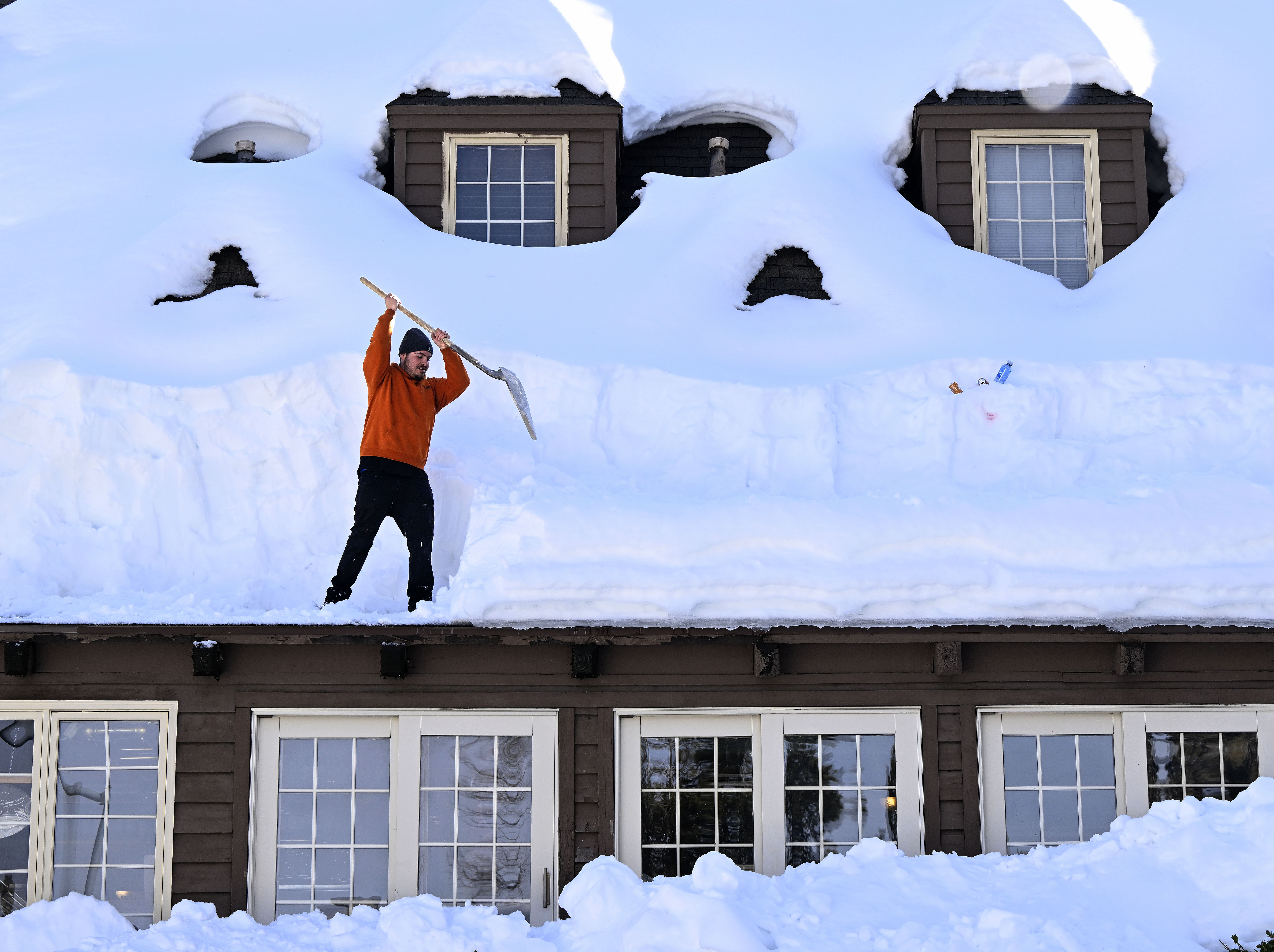
Expect rain in all mountain communities and resorts, which could combine with several feet of existing snow to cause problems, including roof collapses, increased avalanche danger and heavy runoff.
An avalanche March 1 blocked a section of mountain road on Mount Baldy. Mount Baldy Resort tweeted that avalanches were reported in the Movie Slope area.
No injuries were reported.
The rapid flows of snow down a mountain kill more than 150 people worldwide each year, according to the National Weather Service.
Warning signs include cracks in the snow around feet or skis; a hollow feeling to the ground underfoot; 'whumping' sounds indicating that the snow is settling; heavy snowfall or rain in a 24-hour period; rapidly increasing temperatures; and patterns on the snow created by the force of powerful winds.
In the San Bernardino County mountains, unrelenting snow blocked roads, and left some stranded residents running low on supplies. Snow piled up to rooftops in Lake Arrowhead and other communities. In Crestline, the roof of a family owned grocery store collapsed under the weight of snow.
Northern California Storm and the Sierra Nevada Snowpack
The storm will have more severe implications for Northern California, where heavy rain, strong winds, thunderstorms and the threat of flooding are possible in communities already hammered by earlier storms.
The flood threat will come from the combination of rain and melting of parts of the huge snowpack built in California's mountains by nine atmospheric rivers early in the winter and later storms fueled by a blast of arctic air.
The snowpack at high elevations is so massive it should be able absorb the rain, forecasters said. But elevations below 4,000 feet will see melting and runoff. At high elevations the storm was predicted to dump heavy snow, as much as 8 feet in some locations.
California's Sierra Nevada snowpack, which provides about a third of the state's water supply, is more than 180% of the average on April 1, when it is historically at its peak. Ideally, the snowpack melts in spring and summer, then runs off into the state's expansive water supply system.
So much snow has fallen in the Sierra and other mountain ranges that residents are still struggling to dig out days after earlier storms. Roofs collapsed, cars were buried and roads were blocked. Gov. Gavin Newsom declared emergencies in 13 of California’s 58 counties beginning March 1.
The Associated Press contributed to this report.


