
What to Know
- The Rose Parade was chilly, but dry for revelers
- Showers are set to move into the region Tuesday afternoon
- The big rain event starts late Wednesday, and continues overnight Thursday
The 2023 Rose Parade in Pasadena just skated by with clear skies, before a round of showers is set to make its way into Southern California Tuesday.
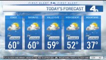
Tuesday had a chilly start to the day, and with clouds around through the afternoon, temperatures aren’t expected to warm up a whole lot.
Highs will generally be in the upper 50s to low 60s.
Get top local stories in Southern California delivered to you every morning. Sign up for NBC LA's News Headlines newsletter.
Timing of the Storm

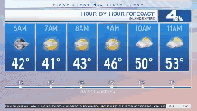
There is a chance for scattered rain and snow showers late this afternoon, but greater chances late Tuesday night into early Tuesday morning as a cold front moves in.
It will also get windy late night in the desert and mountain communities with gusts possibly around 40 – 50 mph.
A stronger storm will be moving in Wednesday into Thursday.
Inland Empire
Wednesday: Scattered showers throughout the day ahead of the weather system.
Overnight into Thursday morning: This is when we’ll likely see widespread heavy rain moving in across the region.
We could see impressive rainfall totals with this system like we did this past weekend. Snow levels look to remain high.
Cold Temperatures
LA County was under a Cold Weather Alert due to chilly temperatures that are expected to dip below 32 degrees.
Lancaster in the Antelope Valley was under a cold weather alert from Tuesday, Friday and Saturday. Mount Wilson was also under a cold weather alert for Thursday.
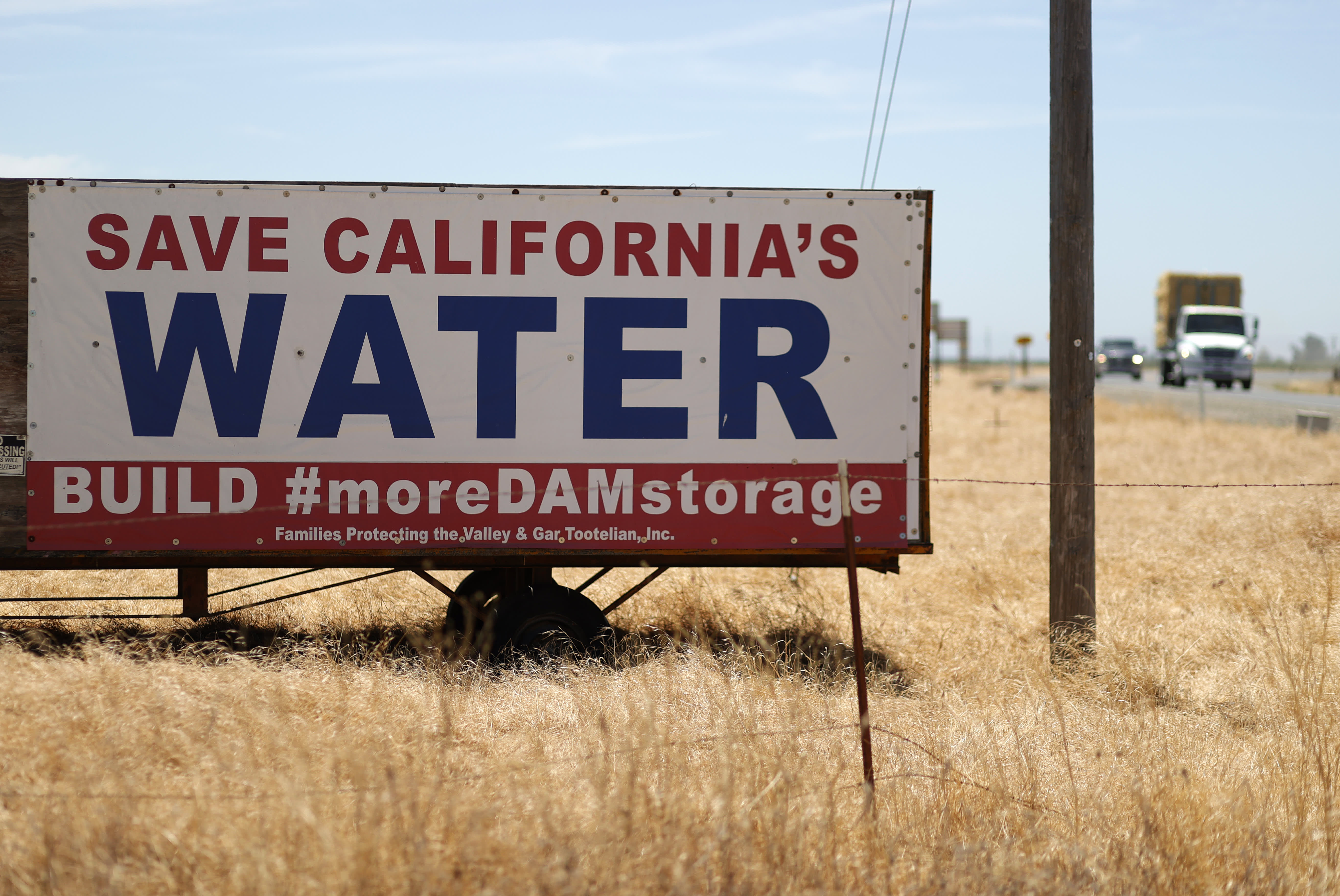

California Drought
Nearly 98 percent of the state remained in drought at the end of December. More than 80 percent of the state was in severe drought, the third most severe category in the weekly Drought Monitor report.
A swath of the agricultural Central Valley north of Los Angeles remained in exceptional drought, the most severe category. Extreme drought stretched from northern Los Angeles County through the central part of the state to the Oregon border.
California has spent most of the last 15 years in drought conditions. The current three-year dry spell included one of the driest late winters on record.
The state's normal wet season runs from late fall to the end of winter, but dismal precipitation left about 95 percent of California in severe drought at the start of spring. By September, nearly all of California was in drought.
Much of California’s water comes from melting snow in the Sierra Nevada Mountains. In an ideal scenario, storms blanket the mountains with snow during winter, building up the natural reservoir. That snow then melts in late spring and early summer, replenishing the state's water system. Snowpack was far below normal in Spring 2022.
California recorded its driest first three months of the year on record to start 2022. The dry stretch followed a promising December when storms drenched parts of the state and brought snow to the Sierra Nevada Mountains.
But late fall storm brought reason for optimism. California's statewide snowpack level was more than 200 percent above normal in mid-December after powerful December storms blanketed the Sierra Nevada Mountains with snow.
In December 2021, statewide snowpack was at a dismal 22 percent to normal.